“THE WILD SIDE OF CHILOÉ”: Conservation in Tantauco Park
Text: Andreea Lotak; Photos: Justin & Andreea Lotak · 15 min read

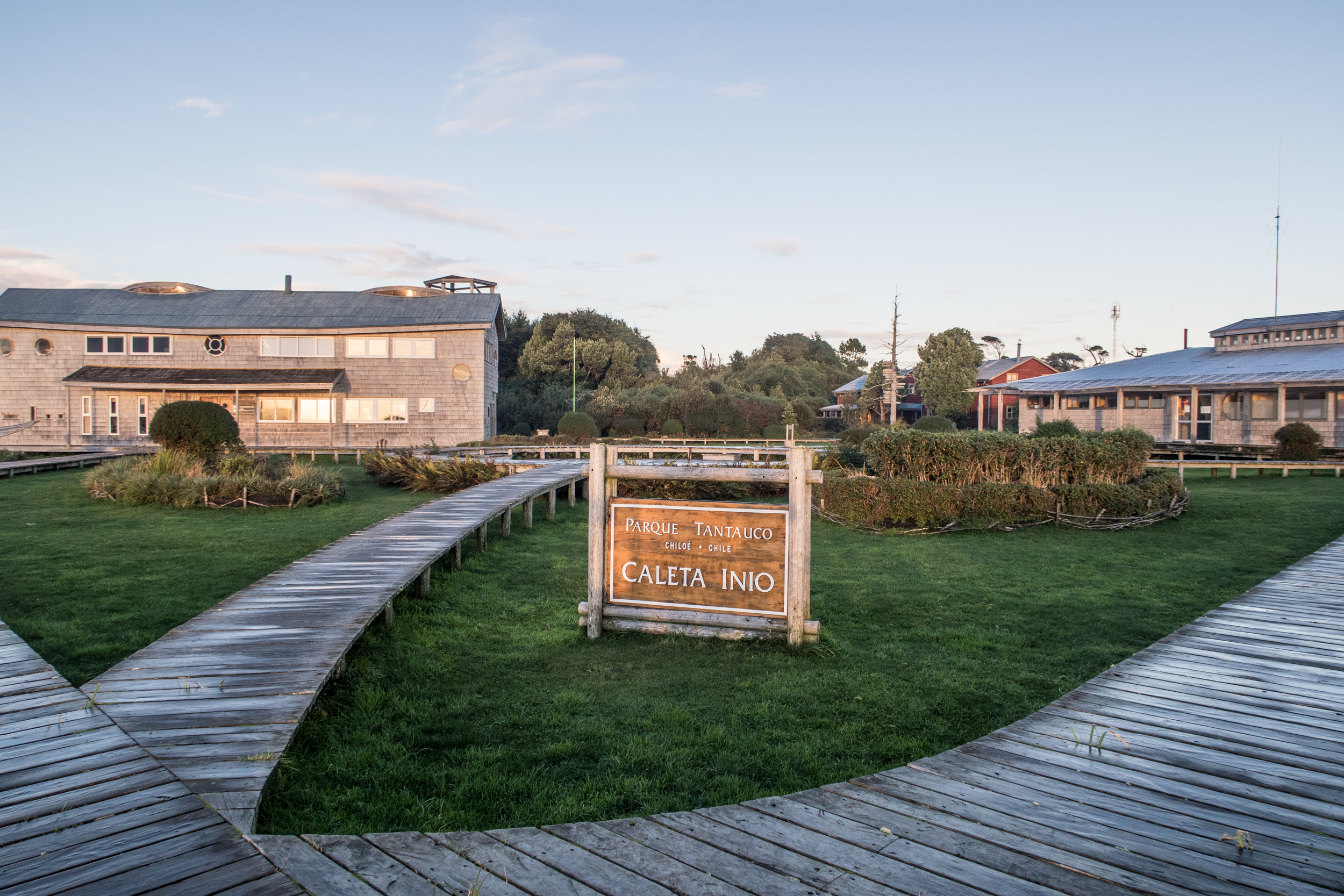
One of the boardwalks across peat bogs in Tantauco Park, on the Island of Chiloé
We arrived on the island of Chiloe about the same time as a major storm which blasted the region for three days. The first night at the park’s headquarters the rain and wind were so strong that we thought our dome would tear and we’d have a waterfall pour in. The next morning, with a break in the clouds, we started our 52km/32 mi hike towards the southern end of the park. Throughout the following four days, this would become one of the most adventurous hikes we’ve ever done. At the same time it would reveal an amazing conservation project with impeccable infrastructure: the result of hard, dedicated work of the park’s staff.
“I’ll tell you a bit about what the park has to offer”, started Alan Bannister, General Manager of Tantauco. Before heading out on our hike we stopped by the main office in Castro for a discussion with Alan and Javiera. Javiera Lucero has been the park’s Guest Coordinator since 2015. As it’s become the habit, we had reached out to learn more about the project from the people directly involved in its creation and management. “We’re 16 people altogether, with rangers and office staff working to protect 118,000 ha [291,584 acres] of land. We were a larger team initially, which has reduced its size because we have gone past the park’s construction phase, and now we’re mostly focused on conservation and the restoration of the ecosystem”, added Alan. “Another focus is sustainable tourism, with the best attractions being the long-distance trails”.
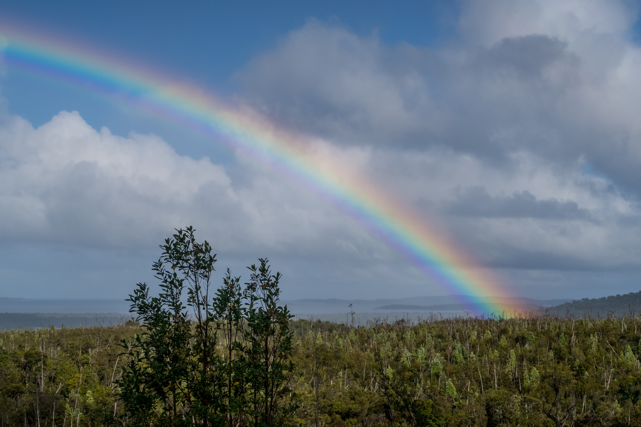
One of those long-distance trails is the Transversal Trail (Sendero Transversal/ST), a 52km hike that connects the northern sector of the park in Chaiguata with the southern headquarters in Inío. The recommended way to do it is to take five days of hut-to-hut hiking, enjoying the beautiful scenery, wildlife and rustic cabins, then heading out of Inío by ferry to Quéllon. That’s not particularly how we did it. Firstly, we only had four days to reach Inio. Secondly, we started hiking with a storm, and the impressive quantity of rainfall turned the trail into a kind of water world. We walked large portions submerged to our hips and got no break from the mud until we reached Inío, making us fight harder for every mile. I’m laughing now, reminiscing from the warmth of a cafe in Santiago, but I might have cried a bit back then. Though the weather gave us a hard time, we were constantly in awe of how nice the huts were, especially when reached after a muddy, wet day. The miles of bridges and boardwalks were just as impressive, because they made us realize how much thought and work had been given to create this trail experience. It’s a tough terrain, even if it’s relatively flat. It’s also truly remote and required materials and other appliances, like the wood-burning stoves, to be brought by helicopter to the different huts and picnic areas along the trail. We were absolutely impressed with the whole infrastructure in Tantauco and also deeply grateful to those who have put it all together for people like us to be able to enjoy one of the most beautiful corners of Chile. Part of the experience, aside from the most amazing old-growth forests we’ve ever seen, was losing count of the many times we slid and rolled downhill in the mud. With all the rain, it seemed like every inch of the trail had become more slippery than ice. But…water under the bridge. That is, wherever the bridge wasn’t under the water (which happened a few times).


"It’s maybe a bad strategy for business, but it’s a good one for the visitor’s experience and for trail conservation"
Returning to our conversation in the office in Castro, we learn more about visitation in the park and how it’s handled in this conservation area. Alan gives us more details: “From Castro or Quéllon there are tour operators that can bring you to the park, but there is no regular public transportation to it. You can also drive down there, but with a lot of patience and with lots of attention, because the road to Yaldad and Chaiguata isn’t paved. In Chaiguata we have domes, campgrounds, a conference hall, and a large common area with a fireplace and kitchen, which during the summer operates as a restaurant. Typically, people spend a couple of days here. 90% of our visitors are Chilean. Now, this time of year [May] you’ll be alone on the trail.” Javiera adds: “Last year we had 7,400 visitors in total, with almost 80% coming in February. That’s when Chaiguata fills up, but the facilities are well handled in a way that it doesn’t feel crowded.”
Asking whether they have done a study to appreciate the impacts and how much people can the park receive sustainably, we get the answer from Alan: “We can have around 10,000 people easily every year. The peak season is well handled, because we don’t overpopulate the camping areas. On the long-distance trails, we don’t allow more than eight people per day to enter. That’s why during peak season one must book the huts ahead of time. Typically, we only allow one night per group or person in a hut, and each hut has a maximum capacity of eight. It’s maybe a bad strategy for business, but it’s a good one for the visitor’s experience and for trail conservation. We never really get overpopulated. What we want to do in the long term is to have people enjoy more options in Yaldad [the northern entrance in the park] when they only come for the day. Although that’s a large area, it still can get quite full now. We want to be able to also absorb some of the people that get turned around if Chaiguata has reached its capacity. The plan is to diversify our options and to be able to get more traffic in Yaldad so that visitors can get a good taste of the park even when only visiting this northern entrance. We’d like to maybe open a cafeteria and even build a campground. However, we don’t want to be a massive park either as far as visitation goes. To summarize: we’re planning on growing Yaldad and preparing it for increased traffic, keep Chaiguata for the crowd that comes to spend a couple of days in the park, then have the long-distance trails and Inío for more exclusive experiences involving small numbers of visitors and longer stays. The new ferry from Quéllon to Inío opened up the Transversal trail for more visitors, because beforehand one could only hike there and back [104km]. Now one can get to Inío by ferry from Quéllon, paying just 1,000 pesos per person [USD$1.5] one way. Alternatively, one could fly to Inío in a small plane from Castro, but it costs 200,000 pesos [~ USD$300] for two people. It leaves from here, behind the office building.”


"The forests on the side of Caleta Zorra are the best preserved old-growth forests of cypress of Guaitecas in Chiloe"
The Tantauco Park, we learn from Alan, hasn’t increased or changed its size since it was established in 2006. The land that is now protected has had a complicated story. Some seventy years ago a massive fire destroyed large forests of the cypress of Guaitecas, the most precious of the tree species here and one that has had a hard time: “They were used to make telegraph poles, to build cattle enclosures in Patagonia, to build poles for vines in vineyards. It’s one of the most exploited trees in Chile”, according to Alan. In the 90s another fire in the south added to the damage and made the slow recovery even harder. Starting controlled fires was a common practice of timber and agricultural operations, but at times they went out of hand and turned into a disaster, as was the case of these fires in Chiloe. In all of Patagonia natural fires are an extremely rare occurrence, as there is seldom any lightning. Therefore, the ecosystem and its species are not adapted to cope with them. A few years before this land became the Tantauco Park, the government had done studies in the area confirming that it had the potential to be a hotspot of biodiversity, with high importance for conservation. This was a first step that would send it on a path of recovery after a long history of exploitation. Passing through various failed economic initiatives with Chilean, French and American ownership, and being subject to local litigations, the land was eventually purchased in 2005 by Sebastian Piñera (Chile’s president in 2010-2014). The Tantauco Park was soon established through the Futuro Foundation, and from a conservation standpoint a lot of progress has been achieved in restoring the ecosystem.
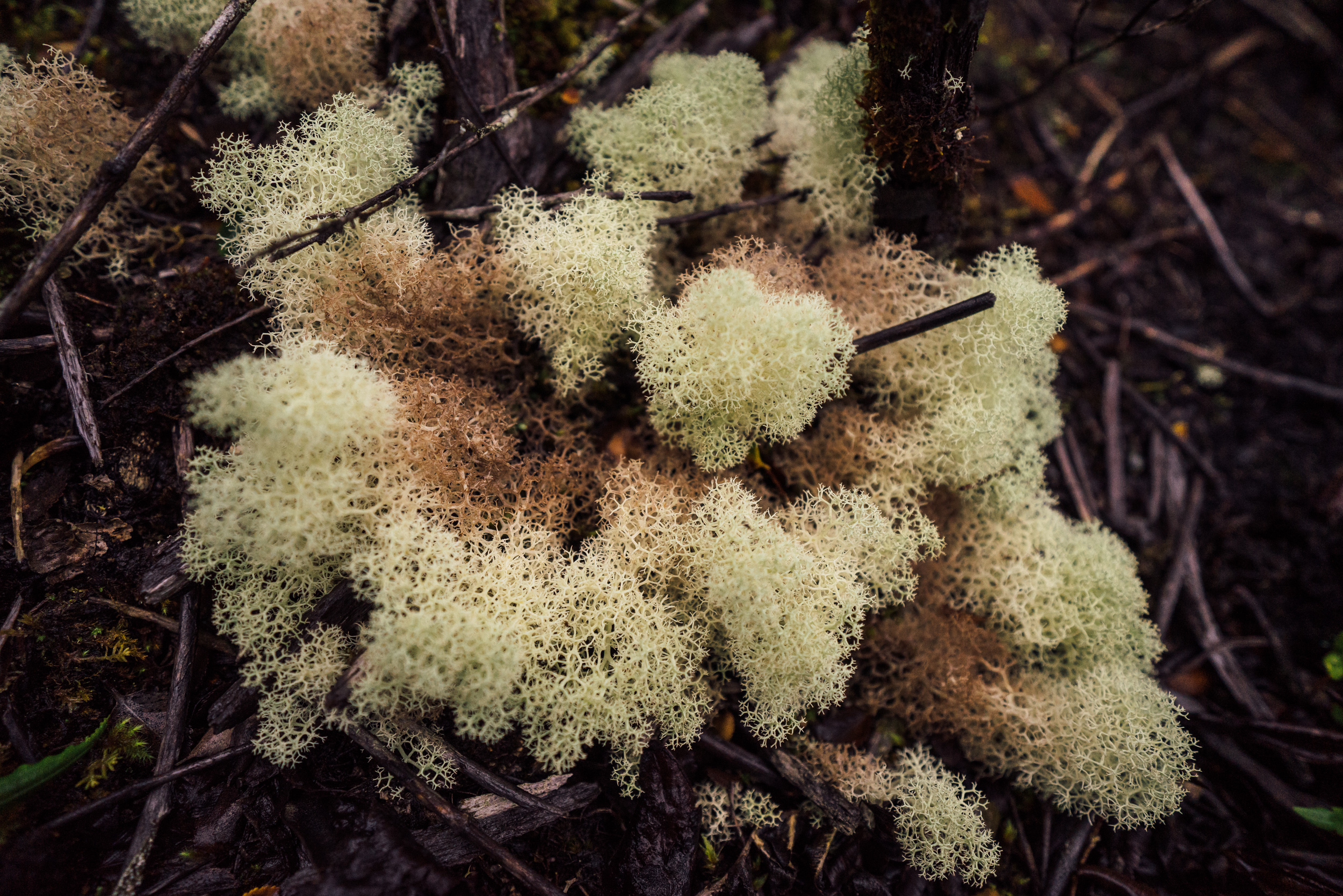
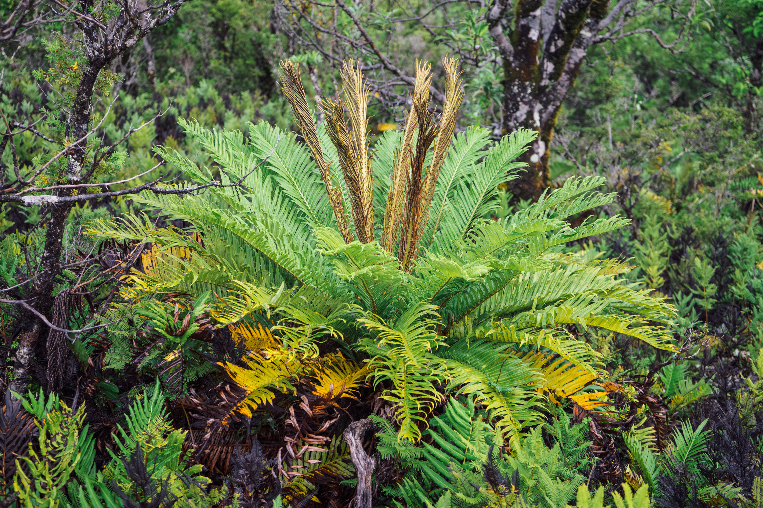
This naturally leads to the question about the park’s biodiversity, which we got to witness while hiking. “The evergreen forests host over 15 species of trees. Animal species of high focus are the Chiloe or Darwin fox, and the Southern Darwin’s frog which is supposed to have some of the healthiest populations here, in the park; we have a species of river otter and the sea otter. Then we have plenty of pudús [the smallest deer species in the world] passing through and eating all the plants that we’re trying to plant and restore (laughs). From the 50,000 seeds we planted, 80% were eaten by pudús. There aren’t a lot of predators of pudú, rarely a fox will eat one. Foxes mostly eat mice or other small animals. If you go quietly on the trail, you’re likely to spot a pudú. These are species common in the South of Chile. The peat bogs cover almost 8,000 ha and are the largest on the island of Chiloe. Outside the park the bogs are being exploited and the sphagnum [peat moss] is extracted under the Law of Mines for different industries. However, the bogs have a high importance for climate change and absorb a lot of carbon from the air. The forests on the side of Caleta Zorra are the best preserved old-growth forests of cypress of Guaitecas in Chiloe. Also, we have more than 72 species of birds”, Alan tells us. The lakes of the vast wetlands comprised within the park are quite poor in nutrients though, due to their chemical composition. As a result, there aren’t a lot of fish here. This factor has led to an interesting situation: these are some of the very few lakes in Chilean Patagonia where the original fauna and flora can be studied and seen, as the trout and salmon were never introduced here. “In the 70s the government dropped salmon from helicopters in all the lakes in the South for fishing. Salmon ends up eating all the other fish or excluding them from the ecosystem. These lakes were spared. They aren’t an ideal place for fly-fishing, but they are a place where one can see the few native species of fish still alive.”
"From the time we plant the seed until the tree is ready to be moved we approximate a success rate of 80%"
After arriving in Chaiguata, we met Manuel and Barbara, the two park rangers on duty, and they shared with us a pretty incredible fact: once every ten years there is a major event of seed dispersal of the cypress of Guaitecas, and this was the time. The next day we walked with them to the tree nursery where they’re working to repopulate native vegetation. Barbara gave us more details: “Every year the cypress spreads seeds, but in small quantities. Then, every ten years, we see a proliferation and they all do it collectively. This is one of those years and we have to take advantage of it. We have seed collection nets in the cypresses, strategically placed in the direction of the wind, four of them every two meters in slightly different positions to better trap the seeds. Sometimes the seeds fall even 20 meters diagonally away from the tree. From those that fall to the ground, the survival rates are very small compared to the rates obtained when we manipulate the seeds. Since it’s a threatened species we have to do everything we can to give it better chances to survive. From the time we plant the seed until the tree is ready to be moved we approximate a success rate of 80%. Once they are planted in the forest the trees have very high survival rates as well.” Luckily, as we learn from Barbara, the pudús don’t eat the little cypress trees. During the winter Barbara and Manuel work to move the cypresses that are ready, from the nursery to the forest parcels they have assigned for this project, and their beds in the garden are repopulated with young trees from the greenhouse. The new seeds are planted inside the greenhouse. It’s a process that takes time and patience. The cypress of Guaitecas takes a long time to grow and reproduce. “I don’t think we’ll get to see these ones in the garden give seeds, we’ll be gone by then”, Barbara laughs. “It takes some 80 years.”


After leaving Barbara and Manuel in Chaiguata, we set out on our four-day rainy adventure. Once we arrived at the last hut on the trail before Inío on our fourth day of hiking, the views opened to the ocean. We walked through a burned forest of cypress, then through a magical old-growth forest which is beyond description. This was the place that was going to get logged for wood chip. Instead, the trees now form a tunnel that transports the hiker into a different world, one with mosses, mushrooms, and prehistoric snails and flatworms. Upon arriving in Inío we were greeted by the sun, first day of seeing it in the entire hike. The ranger in Inío was kindly waiting to take us to the comfortable guesthouse.
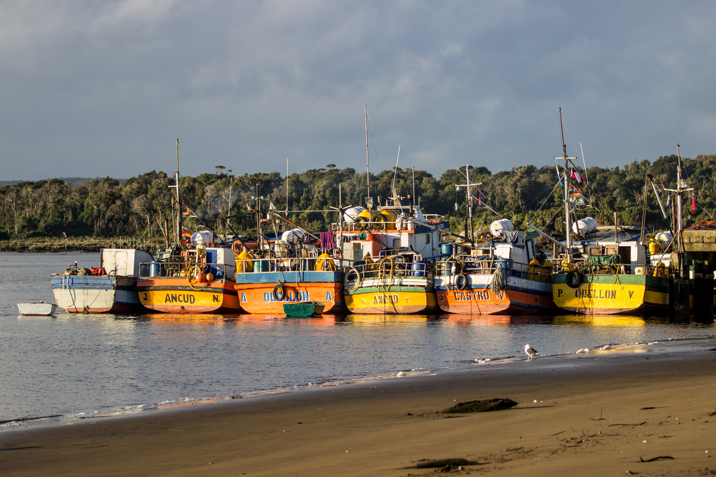
The infrastructure here includes a lookout tower, a tree nursery and vegetable garden, a small plaza, the park’s offices, a health station, a school and a helipad, aside from the campground and the guesthouse for lodging. Inío is a small fishing community where 40 families live in relative isolation. According to Alan and Javiera, it’s also where the park’s most beautiful trail is: a 21km loop that circles through the old-growth forest, on to the beach, passing the old lighthouse and some archeological sites of the Chono indigenous people. Halfway through hikers can spend the night in the Quilanlar hut. “I’d say that Inío is of high interest for foreign visitors and Chileans alike. They can go whale watching, the guesthouse is nice, the trails here are incredible, the lighthouse is impressive, there’s a museum, and the community is very interesting. You can get to know people and eat at their house, it’s a more authentic experience.” We can vouch for the latter, as we got an invitation within the first ten minutes of walking on the beach and meeting some of the locals.
***
Tantauco was wild and beautiful. Its story is inspiring because it stands proof to the resilience of ecosystems and their restorative power if given the chance. The forests here have gone a long time living under the threat of exploitation, and through the dedication of a handful of people the trees have finally found peace. The biodiversity has started to return. If you find yourselves planning for a trip to Chile, witnessing the wild beauty of Tantauco should be high up on the list.

ringed kingfisher (Megaceryle torquata)
A ringed kingfisher, a species ranging from southern US to the bottom of South America, defying the rain and wind in search for fish in one of the lagoons next to the Piramide refuge.

The silhouette of the lighthouse in Inío at sunset. A 21 km loop trail starting right outside this fishing village can take the visitor through beautiful, green forests, along the beach, to the lighthouse and to some archeological sites of the Chono indigenous people. Halfway through one can spend the night at the hut in the Quilanlar refuge.
For a detailed description of the hike and some the species that can be seen while on the Transversal Trail, read our blog post here.


On a land destined to be logged, some of the most pristine valdivian temperate forests are now protected by this Nature Conservancy reserve. With its rugged coasts, ancient trees, impressive sand dunes, and local culture, it is a beautiful place to explore. Interview with Liliana Pezoa, administrator of the reserve.